grande boucle entre Maidières et la petite Suisse
- Mis à jour le 28/07/2023
- Identifiant 2181009
Sélectionner le fond de carte

PLAN IGN

PHOTOS AERIENNES

CARTES IGN MULTI-ECHELLES

TOP 25 IGN

CARTES DES PENTES

PARCELLES CADASTRALES

CARTES OACI

CARTES 1950 IGN

CARTE DE L’ETAT-MAJOR (1820-1866)

Open Street Map
Afficher les points d'intérêt à proximité
Hébergements
Informations
Lieux d'intérêts
Producteurs
Restauration
Services et Commerces
Autre
Echelle
|
durée / niveau
Rando pédestre
|
distance
32,1 km
type parcours
Boucle
|
|||||||||
|
Lieu de départ
54700 Maidières
|
accessibilite
|
|||||||||
|
prestations payantes
Non
|
type(s) de sol
Graviers
Terre Herbe |
|||||||||
description
difficile. A recommander. Coin super sympa. Foret et champs et ruisseau.
Hébergements à proximité

infos parcours (33)
1
Saint-Jean. Après l'
Informations complémentaires
kilomètre
20,77
latitude
48.8536
altitude
222
m
longitude
5.93736
2
Place de la Fontaine à Gézoncourt
Informations complémentaires
kilomètre
14,08
latitude
48.8367
altitude
228
m
longitude
5.99517
3
Moulin de Villevaux
Informations complémentaires
kilomètre
14,89
latitude
48.8324
altitude
208
m
longitude
5.98706
4
Intersection dans le Bois de Rogéville
Informations complémentaires
kilomètre
15,94
latitude
48.8286
altitude
263
m
longitude
5.97479
5
Patte d'oie de Forge Prés
Informations complémentaires
kilomètre
17,28
latitude
48.836
altitude
221
m
longitude
5.9618
6
Forge Prés
Informations complémentaires
kilomètre
17,54
latitude
48.8379
altitude
220
m
longitude
5.95997
7
Intersection du Fond de Séconvaux
Informations complémentaires
kilomètre
17,70
latitude
48.8368
altitude
226
m
longitude
5.95829
8
La Jus
Informations complémentaires
kilomètre
18,15
latitude
48.8389
altitude
215
m
longitude
5.95452
9
Martincourt
Informations complémentaires
kilomètre
19,43
latitude
48.8457
altitude
227
m
longitude
5.94777
10
Lavoir de Gézoncourt
Informations complémentaires
kilomètre
50,36
latitude
48.8388
altitude
231
m
longitude
5.99461
11
Intersection après Saint-Jean
Informations complémentaires
kilomètre
43,25
latitude
48.8545
altitude
221
m
longitude
5.93644
12
Intersection de la cote 238
Informations complémentaires
kilomètre
40,77
latitude
48.8735
altitude
236
m
longitude
5.93979
13
Intersection avec une piste avant Mamey
Informations complémentaires
kilomètre
39,84
latitude
48.8778
altitude
296
m
longitude
5.95034
14
Carrefour à l'entrée de Mamey
Informations complémentaires
kilomètre
39,37
latitude
48.878
altitude
319
m
longitude
5.95674
15
Carrefour de l'église à Mamey
Informations complémentaires
kilomètre
38,98
latitude
48.8749
altitude
326
m
longitude
5.95798
16
Intersection du Vaux de Châtel
Informations complémentaires
kilomètre
36,95
latitude
48.8802
altitude
304
m
longitude
5.98448
17
Église de Maidières, Place Nicolas Maire
Informations complémentaires
kilomètre
64,16
latitude
48.9005
altitude
190
m
longitude
6.0386
18
Église de Maidières, Place Nicolas Maire
Informations complémentaires
kilomètre
64,16
latitude
48.9005
altitude
190
m
longitude
6.03859
19
Intersection des Rayes.
Informations complémentaires
kilomètre
51,50
latitude
48.8459
altitude
269
m
longitude
6.0036
20
Griscourt
Informations complémentaires
kilomètre
53,08
latitude
48.8339
altitude
215
m
longitude
6.01362
21
Intersection avec la D107
Informations complémentaires
kilomètre
53,55
latitude
48.8378
altitude
201
m
longitude
6.01582
22
Intersection avec la Route de la Vau Châtel
Informations complémentaires
kilomètre
55,18
latitude
48.8493
altitude
209
m
longitude
6.02269
23
Intersection avec la Route de la Vau Châtel
Informations complémentaires
kilomètre
56,03
latitude
48.8447
altitude
203
m
longitude
6.02965
24
Aire de pique-nique de Langrepont
Informations complémentaires
kilomètre
56,54
latitude
48.8481
altitude
219
m
longitude
6.03407
25
Intersection dans le Bois des Antoinistes
Informations complémentaires
kilomètre
57,28
latitude
48.8532
altitude
259
m
longitude
6.02939
26
Intersection de sous le Quart en Réserve.
Informations complémentaires
kilomètre
57,74
latitude
48.8569
altitude
263
m
longitude
6.03209
27
Intersection de la Vau Saint-Aubin
Informations complémentaires
kilomètre
58,26
latitude
48.8613
altitude
250
m
longitude
6.03386
28
Départ du Chemin de la Vaux Crinière
Informations complémentaires
kilomètre
59,00
latitude
48.8661
altitude
225
m
longitude
6.03881
29
Départ de chemin Rue Jean Mermoz
Informations complémentaires
kilomètre
59,56
latitude
48.871
altitude
207
m
longitude
6.03807
30
Intersection de la Rue du Ruisseau.
Informations complémentaires
kilomètre
59,68
latitude
48.8717
altitude
196
m
longitude
6.03893
31
Carrefour du Vau du Ruché.
Informations complémentaires
kilomètre
60,28
latitude
48.8733
altitude
241
m
longitude
6.03106
32
Carrefour de la Folie.
Informations complémentaires
kilomètre
63,10
latitude
48.8964
altitude
261
m
longitude
6.02721
33
Rue de Puvenelle
Informations complémentaires
kilomètre
64,02
latitude
48.9005
altitude
192
m
longitude
6.03671
laurie
Note moyenne
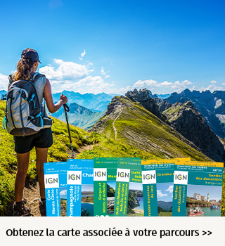
Cartes associées